PHOTO COURTESY OF ODA
[quote style=”2″]Umatilla Water Basin at 104 Percent of Average[/quote]
What a difference a wet winter makes. All areas of Oregon appear to be in much better shape for the upcoming growing season than one year ago when many farmers and ranchers wondered if there would even be enough water to carry into the summer. It’s only April, so conditions can always change. But talk of drought in Oregon, for now, seems to be relatively muted.
“Most of the state is doing better,” says Margaret Matter, water resource specialist with the Oregon Department of Agriculture. “We need to still keep an eye on parts of southeast Oregon, but everything is certainly improved over last year.”
In several categories of data used to determine the water supply situation, the numbers generally show Oregon to be near, at, or above average for this time of year. According to the USDA’s Natural Resources Conservation Service (NRCS), statewide streamflow conditions are nearly 120 percent of average. The US Drought Monitor says there are no longer any areas of extreme drought in Oregon with only about eight percent of the state– primarily in the southeast part of the state– still categorized as experiencing severe drought.
“We still use the dreaded d-words, dry and drought, since there have been a number of intensely dry years in parts of the state,” says Matter. “But again, things appear to be much better for 2016.”
t’s hard to imagine what Oregon would be like this spring had the winter spigot been turned off. Fortunately, the state recorded one of its wettest winters ever, with the bulk of the precipitation falling in December and January. In higher elevations, that translated into some strong snowpack numbers. For the current water year, which began in October, nearly all basins show dramatic improvement. Last April 1, the Owyhee and Malheur basins in southeast Oregon recorded a snowpack of just 10 percent of average. This year, that figure is 91 percent. Last year, the Grande Ronde, Power, Burnt, and Imnaha basins were at 31 percent of average. This year, they are at 108 percent. The John Day Basin has improved from 8 percent of average to 105 percent. Umatilla, Walla Walla, and Willow basins have gone from 19 percent to 104 percent. The Upper Deschutes has gone from 13 percent to 106 percent. The Klamath Basin was at 13 percent of average this time last year, it is now at 112 percent. Even west of the Cascades, the snowpack picture is much brighter this April. The Willamette Basin has gone from 8 percent of average to 91 percent and the Rogue and Umpqua basins have improved from 14 percent to 110 percent.
While the winter was wet, it was also relatively warm. That meant plenty of rain, especially on the west side of the state.
“It was the seventh warmest winter on record for us,” says Matter. “The rain we received on the west side was intense. Portland, for instance, received about 10 inches more than average.”
Although April precipitation in the higher elevations could result in more snow, it’s likely that any precipitation is going to fall as rain this time of year. About 70 percent of Oregon’s annual snowpack is normally on the ground by the first of February.
Oregon’s irrigation reservoirs have generally benefitted from the wet winter. The most dramatic improvement is in Lake County and Goose Lake basins, where last year’s reservoir storage was just 35 percent of average at this point in the season. Today, it’s at 105 percent. A few basins are actually behind last year’s pace, but not dramatically low. Those include reservoirs in Grande Ronde and Klamath basins.
With snowpack and reservoir storage looking relatively good– key indicators of Oregon’s statewide water picture– the streamflow forecast has observers cautiously optimistic about the rest of the year.
“Like the other indicators, streamflow appears to be near, at, or above normal, but a few places, including the Klamath and Umatilla basins, streamflows may be a bit lower,” says Matter. “When it all shakes out, streamflows may not be quite as high as we predict because the sub-surface and groundwater are so depleted after so many years of dry conditions. There has not been enough natural recharge in most areas.”
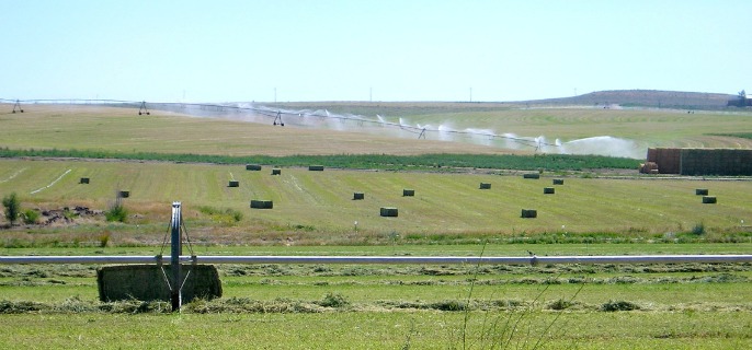
Many irrigation districts around the state have turned on their systems with the hope that the water continues to flow well into the summer months. The Owyhee Irrigation District started a week earlier than planned after high winds had dried out the soil following spring plantings. Others are on schedule.
With an eye on water shortages last year, some growers made the decision to change from high-value crops that require more irrigation to lower value crops– in some cases, planting grain instead of vegetables. More land was put into fallow status or less acreage was planted. Some livestock producers ended up buying more feed than usual because they weren’t able to produce enough feed on their own operation. None of those types of decisions appear to be necessary this year.
In the meantime, weather over the next several weeks and months could alter the picture for agriculture.
“The best case scenario would be for it to stay cool, not get too warm too fast ,” says Matter. “That would allow the snowpack to melt off in a more time-released fashion that could prolong streamflows well into the summer. If temperatures rise more quickly, the snowpack will melt faster. Farmers are eternal optimists, yet they are careful because they know how quickly things can change.”


