









UMATILLA COUNTY, Ore.-UPDATE. July 20. Lower Dry Creek Fire Contained
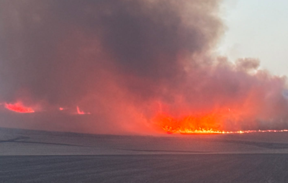
Fire crews reached 100% containment on the Lower Dry Creek Fire southwest of Milton-Freewater over the weekend.
Firefighters made rapid progress controlling the fire perimeter, putting out hot spots and mopping up on July 18.
According to the final briefing on the Lower Dry Creek Fire from the Oregon State Fire Marshal (OSFM), 100% containment means control lines have been established around the incident and fire crews are confident the fire will remain inside those boundaries.
“Partnerships were key on this fire,” said Incident Commander Ian Yocum. “The unified response of local, county, state and mutual aid partners limited additional losses. We are grateful to ODF and all our structure firefighters for safely bringing this fire to a strong conclusion,”
The Department of Oregon State Fire Marshal Team and Oregon Department of Forestry have now demobilized, and incident management has transitioned back to local fire jurisdictions as of 1 p.m. on July 19.
The Lower Dry Creek Fire burned a total of 8,096 acres. The cause of the fire that destroyed six homes and 40 outbuildings is currently under investigation.
Previous coverage. July 17
The Lower Dry Creek Fire is now 20% contained after fire crews were able to make progress on the fire burning southwest of Milton-Freewater overnight on July 16.
According to the July 17 morning briefing on the Lower Dry Creek Fire from the Oregon State Fire Marshal (OSFM), crews worked on building and strengthening up to 100 feet of defensible space around homes and other structures in the area overnight.
While some evacuation levels for the Lower Dry Creek Fire have been reduced, five homes have now been destroyed in the fire.
Formal damage assessments and homeowner notifications are now underway, according to the OSFM. The Umatilla County Emergency Management Office will contact homeowners whose properties have been affected by the fire.
East Umatilla Rural Fire and Rescue, the Oregon Department of Forestry, and the City of Milton-Freewater initially responded to the fire that started July 15 and threatened Milton-Freewater, Athena, Weston, Adams, and Tollgate.
The fire spread quickly due to dry, windy conditions and evening thunderstorms, leading Governor Tina Kotek to invoke the Emergency Conflagration Act for the fire on the night of July 15 and the Oregon State Fire Marshal mobilized resources to send to the fire.
The Oregon State Fire Marshals (OSFM) Red Incident Management Team assumed command of the fire on July 16, and 195 firefighters are now responding, with 15 engines, two water tenders and three bulldozers on site.
FEMA also approved a Fire Management Assistance Grant (FMAG) to help fight the Lower Dry Creek Fire on July 16. Under FMAG grants funding is available to cover up to 75 percent of a state’s eligible firefighting costs for fires that threaten to become major disasters.
The Lower Dry Creek Fire is currently burning an estimated 6,753 acres.
The Red Cross emergency shelter is still open at Sunridge Middle School at 700 SW Runnion Avenue in Pendleton. Livestock and horses may also be taken to the Pendleton Round-Up grounds at 1205 SW Court Avenue.
The Umatilla County Sheriff’s Office (UCSO) will continue to provide updates on evacuation levels for the Lower Dry Creek Fire online.
Evacuation levels as of 11:15 a.m. July 17
LEVEL 1 (BE READY)
UMC-151-C, UMC-151-A and WEW-115 cover the area north of Wildhorse Road, south of Highway 204, east of Schrimpf Road and DeGraw Road, and west of Weston Mountain.
MIF-073-A covers the area west of Couse Creek, east of Highway 11, south of Sykes Boulevard, and north of Alderbanks Vineyard.
UMC-117-B covers the area south of Basket Mountain Road, north of Highway 204, west of Hodgson Road, and east of Schiewe Lane.
LEVEL 2 (BE SET)
UMC-123: Includes South Fork Walla Walla River Road.
UMC-075-A: Includes Lincton Mountain Road.
UMC-077-A: Includes Walla Walla River Road and forms the northern boundary of the evacuation area.
LEVEL 3 (GO NOW!)
UMC-071-E: East of Pine Creek and south of Lower Dry Creek Road.
UMC-071-F and UMC-071-B: West of Highway 11, including Steen Road and York Road north of Highway 11.
UMC-117-C: Includes the Highway 204 and Steen Road area.
UMC-117-D: Includes Couse Creek Road.
UMC-117-E: North and east of Highway 11.
UMC-075-B: North of Basket Mountain Road.
UMC-075-C: Includes Coe Road and Cache Hollow Road.
While residents are able to return in LEVEL 1 and LEVEL 2 areas, they should remain aware of ongoing fire operations and use caution around emergency personnel and equipment.
LEVEL 3 areas will remain in effect for now, not only to ensure the safety of the public, but ensure emergency personnel on the fire can safely continue with their mission.
Couse Creek Rd remains closed until further notice.