










UMATILLA COUNTY, Ore.-UPDATE. July 23. 11:45 a.m.
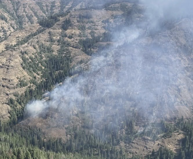
Evacuation levels for the Hagen Fire currently burning an estimated 8,620 acres about nine miles Southwest of Tollgate have been increased.
Northwest Incident Management Team 7 is managing the Hagen, Paradise, Horse Ridge, and Ninemile Fires, all burning in the Umatilla National Forest and will provide daily updates.
The Oregon State Fire Marshal has mobilized an incident management team and three structural task forces to this fire and is in unified command with Northwest Team 7.
The UCSO will continue to provide information that affects Umatilla County, including evacuation levels and road closures online.
Current evacuation levels for Hagen Fire
LEVEL 1 (BE READY)
- UMC-1406030-A
- UMC-1406024-A
- UCO-140630-A
- UCO-140624-S
This is the area to the north of Spout Springs and north to USFS 3725. LEVEL 1 evacuation levels have been issued for the area east of Hwy 204 and north of USFS 3725 and 3701 Roads, south and west of power line corridor along USFS 030 and 054 roads, including Spout Springs Ski Area.
LEVEL 2 (BE SET)
- UMC-123-D
- UMC-1406020
- UMC-1406018-A
- UMC-1406018-B
- UMC-1406014-A
- UMC-1406012
- UCO140618-N
- UCO-140618-S
Includes the area east of McIntyre Road and Fawn Lane, including the entire Langdon Lake area within Umatilla County.
A LEVEL 1 evacuation notice in the area east of Hwy 204 and north of USFS 3725 and 3701 Roads, south and west of power line corridor along USFS 030 and 054 roads, including Spout Springs Ski Area has been issued in Union County.
LEVEL 2 (BE SET)
- UMC-149-D
Within the Confederated Tribes of the Umatilla Indian Reservation (CTUIR) boundary in the Bingham Road area, the area just south of Hansel Road (above the LEVEL 3 area of GIBBON).
LEVEL 3 (GO NOW)
- UMC-1406056
- UMC-1406018-C
- UMC-1406014-B
- UMC-1406013-B
Includes the areas east of the Forest Service Road 32 in the North Fork Wilderness area, including Grouse Mountain.
Previous Coverage
Evacuation levels for the Hagen Fire currently burning about 7,419 acres about nine miles Southwest of Tollgate have been increased.
Northwest Incident Management Team 7 is managing the Hagen, Paradise, Horse Ridge, and Ninemile Fires, all burning in the Umatilla National Forest and will provide daily updates.
The UCSO will continue to provide information that affects Umatilla County, including evacuation levels and road closures online.
Current evacuation levels for Hagen Fire
LEVEL 1 (BE READY)
Evacuation Zones
- UMC-151-F
- UMC-151-E
- UMC-155-A
- UMC-157
- UMC-215-F
- UMC-215-C
- UMC-215-B
- UMC-213-E
- UMC-213-D
LEVEL 1 evacuation area extends west on Bingham Road from Iskuulpa Creek to Buckaroo.
LEVEL 2 (BE SET)
Evacuation Zones
- UMC-215-E
- UMC-1406007-B
- UMC-149-B
- UMC-149-C
- UMC-151-G
- UMC-151-H
- UMC-151-D
- UMC-153
- UMC-155-B
- UMC-215-A
- UMC-215-D
- UMC-243
The Level 2 evacuation is expanded west on Bingham Road between Meacham Creek and Iskuulpa Creek to include Gibbon.
LEVEL 3 (GO NOW)
Evacuation Zones
- UMC-1406015-A
- UMC-1406016-B
- UMC-1406016-C
- UMC-1406017-A
- UMC-1406017-B
- UMC-1406053-A
- UMC-1406053-B
- UMC-1406053-C
- UMC-1406015-C
- UMC-1406015-D
LEVEL 3 evacuation area has expanded west on Bingham RD to Meacham Creek Rd. LEVEL 3 includes Bingham RD from Meacham Creek Rd to the 32 road, including the Umatilla River Corridor and Hagen Creek.
The Emergency Conflagration Act was invoked on the afternoon of July 21 to provide additional resources to fight the Hagen Fire, and the Oregon State Fire Marshal is mobilizing an incident management team and two structural task forces to the Hagen Fire that will operate under the command of Northwest Team 7.
UPDATE. 3 p.m. July 20
Evacuation levels have been increased for the Hagen Fire currently burning about 3,794 acres about nine miles Southwest of Tollgate.
Northwest Incident Management Team 7 is managing the Hagen, Paradise, Horse Ridge, and Ninemile Fires, all burning in the Umatilla National Forest and will provide daily updates.
The UCSO will continue to provide information that affects Umatilla County, including evacuation levels and road closures online.
Current evacuation levels for Hagen Fire
LEVEL 1 (BE READY)
Evacuation Zones
- UMC-1406006
- UMC-1406007-B
- UMC-151-F
- UMC-151-I
- UMC-155-A
- UMC-157
- UMC-215-E
The Level 1 evacuation area extends west of Meacham Creek for approx 5 miles south of Bingham Rd and the area north of Pine Creek to Highway 204.
LEVEL 2 (BE SET)
Evacuation Zones:
- UMC-1406015-C
- UMC-1406015-D
- UMC-149-B
- UMC-149-C
- UMC-151-G
- UMC-151-H
- UMC-153
- UMC-155-B
- UMC-215-A
- UMC-215-D
- UMC-243
The Level 2 evacuation area includes north of Bingham Road to Pine Creek and the western boundary follows the contour of Wildhorse Rd up to Pine Creek.
LEVEL 3 – GO NOW!
Evacuation Zones:
- UMC-1406015-A
- UMC-1406016-B
- UMC-1406016-C
- UMC-1406017-A
- UMC-1406017-B
- UMC-1406053-A
- UMC-1406053-B
- UMC-1406053-C
The Level 3 evacuation area includes Bingham Road between milespost 20 to the 32 Road and 6.6 miles of Bingham Rd 6.6 miles,including the Umatilla River Corridor and Hagen Creek.
Previous coverage
Evacuation levels remain in place for the Hagen Fire, one of four wildfires currently burning in the Umatilla National Forest.
The Umatilla County Sheriff’s Office, Umatilla County Emergency Management, and the Confederated Tribes of the Umatilla Indian Reservation (CTUIR)issued evacuation notices on July 19 for the fire about nine miles Southwest of Tollgate, Oregon.
Northwest Incident Management Team 7 is managing the Hagen, Paradise, Horse Ridge, and Ninemile Fires, all burning in the Umatilla National Forest and will provide daily updates.
The UCSO will continue to provide information that affects Umatilla County, including evacuation levels and road closures online.
Hagen Fire evacuation levels as of July 19
Level 1 (Be Ready)
- UMC 151-F
- UMC 151-H
- UMC 151-G
- UMC 151-D
- UMC 155-A
- UMC 155-B
- UMC 157
- UMC 215-A
- UMC 215-E
- UMC 1406007-B
The Level 1 evacuation area extends from the intersection of Wildhorse Road and Abel Road, north to Highway 204, and east to National Forest Road 37-15. This includes all areas north of Wildhorse Mountain and Grouse Mountain to Highway 204, between Wildhorse Road and National Forest Road 37-15.
Level 2 (Be Set)
- UMC 149-C
- UMC 149-B
- UMC 215-D
- UMC 1406015-D
- UMC 1406015-C
- UMC 1406015-A
The Level 2 evacuation area includes Bingham Road from the Confederated Tribes of the Umatilla Indian Reservation (CTUIR) boundary to Meacham Creek. It also includes all areas south of Wildhorse Road, between Reed Road and Hawley Road, extending east to the intersection of Abel Road and Bell Road.
Level 3 (Go Now)
The Level 3 evacuation area includes Bingham Road and Umatilla River Corridor and Hagen Creek area.
Four wildfires burning in Umatilla National Forest
- Hagen Fire: Fire about nine miles Southwest of Tollgate has currently burned an estimated 1,183 acres
- Paradise Fire: Fire ten miles Southeast of Walla Walla has burned 377 acres
- Horse Ridge Fire: Fire five miles Northeast of Meacham has burned 380 acres
- Ninemile Fire: Fire about four miles Southwest of Tollgate has burned about 19 acres